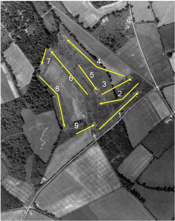
7 October 1946
Some notes about the photograph
- North is towards the top right hand corner of the photograph.
- At the top left edge there is evidence of the Canadian encampment.
- The other clumps of white structures are left over war structures.
- There was no club house, just a Nissen hut.
- The ground to the North of the 4th fairway was cultivated.
- The ground between the 6th and 8th fairways was cultivated.
- The ground to the East of the 9th fairway was cultivated.
- The cricket wicket was between the 2nd green and the 1st fairway.
- The cricket pavilion is between the 2nd green and the 3rd tee.
- There is a copse to the East of the first fairway.
- There is a bridle path across the middle of the course passing South of the 9th green in a straight line to the back of the 4th green
- The line of yew trees stretching across the course is the parish
boundary between Droxford and Corhampton.